I came across the original maps for the Horley circular walk that Mike Patching, Margaret Condon and I worked from with Kevin Larner (CDC), more to follow… Debra
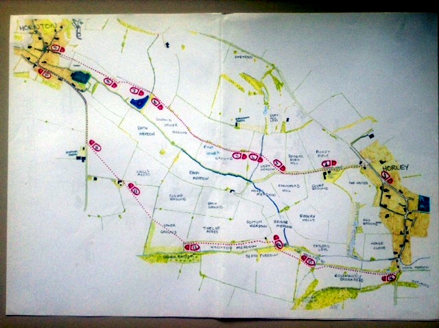
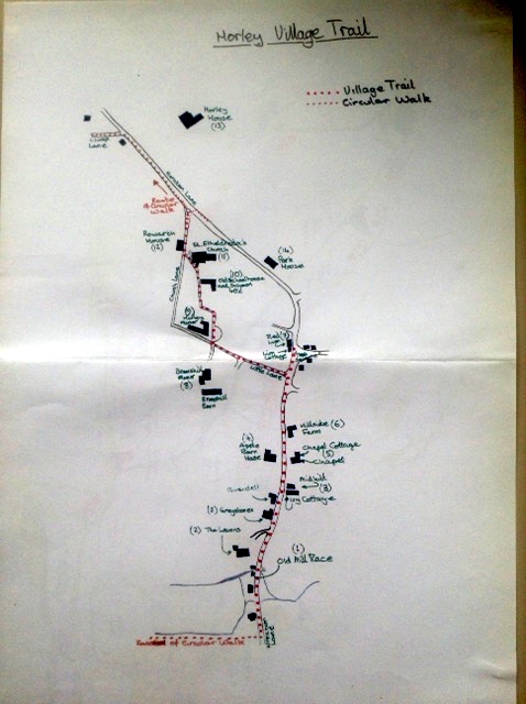
Click here for the offical map of the Horley Circular Walk. It includes some information about the village as well as the fields that connect us to Horton. For the latest details and updates you can see it and other village walks on Cherwell District Council
Points of Interest on the walk:
> Clump Lane and Clump Ground indicate the presence of clay pits, used to make brick.
>Copt Hill Leys means hill with either a peaked or flat top, with the leys being grassland.
> ‘Ragnell Bottom’ has been combined with top, middle, or bottom field based on the person who acquired that field in the 1766 inclosure
> Brook Field and cottage are recognisably by their descriptive, however Wroxton Meadow was the burial place of old farm horses and not “Horse Close”.
> The Roman Vineyard -was on the south facing bank along Hornton Lane, in the nineteenth century the remains of a substantial Roman villa were found here.
> Horley Brook flows down to the old mill race sluices and feeds ancient fishponds.
> The soil is coloured rich red by the ironstone, the old Ironstone Railway ran over Wroxton Lane and once transported locally quarried ore to the railhead in Banbury

Pingback: What’s New – June | TheHorleyViews.com